Cartographic production
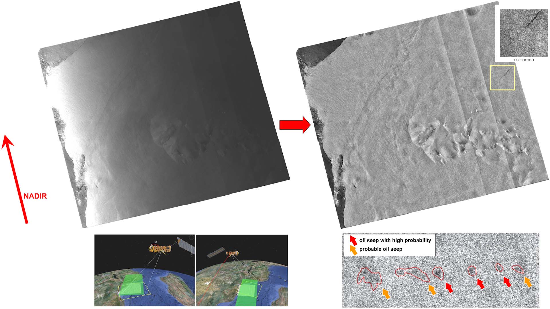
VisioTerra has a recognized competence in the knowledge of the missions and instruments of observation of the Earth. This competence is recognized by the European Space Agency and by the Copernicus Academy label obtained from the European Union. VisioTerra has accompanied oil companies on all the seas of the world for the production of tens of thousands of geocoded and processed radar images in order to detect oil seepages from natural oil leaks from the ocean floor or large lakes. VisioTerra has produced dozens of studies that required the construction of GIS projects fed by geocoded images, WMTS feeds from VtWeb or event boundaries detected by geoservices (see FLEGT Watch).
Thanks to its expertise in the physics of instruments and imaging geometries, VisioTerra has developed functions for geocoding, orthorectification, calibration, radiometric analysis, time series processing, classifications (classical and machine learning), restitutions... Several techniques have been invented by VisioTerra such as the equalization of radar images at sea ("Cross Section Equalization" or RCSE), the combination of land/sea processing, 3D restitution of scalar values...
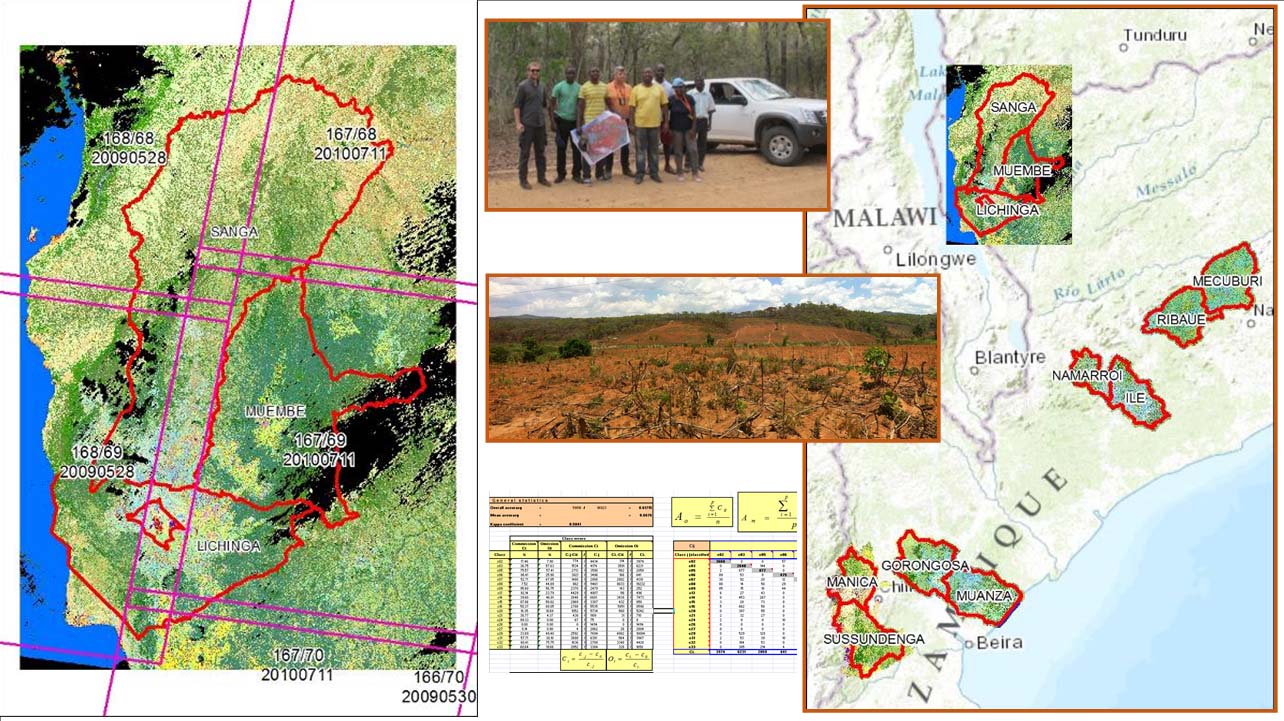
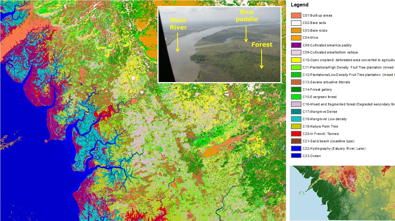
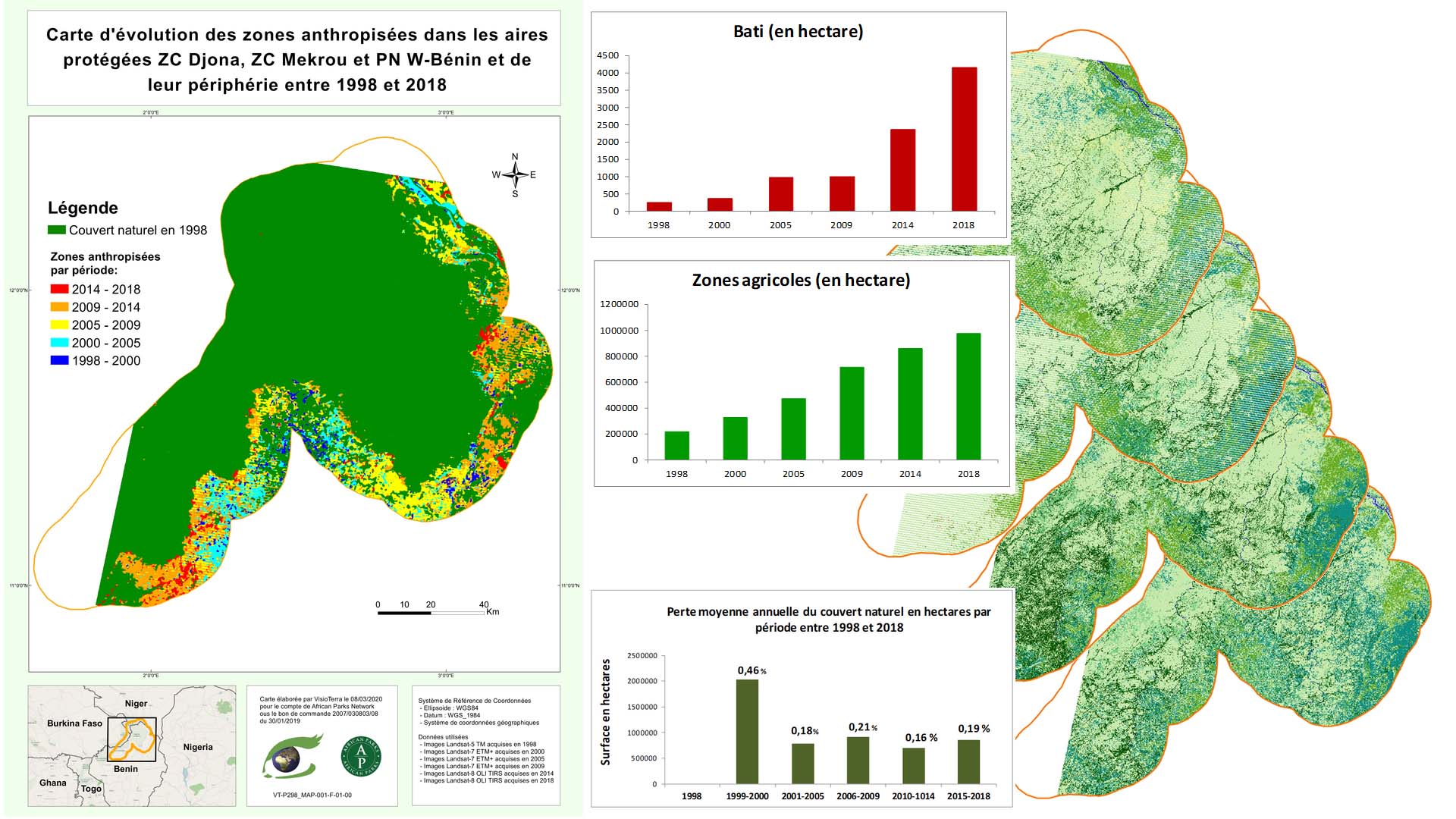
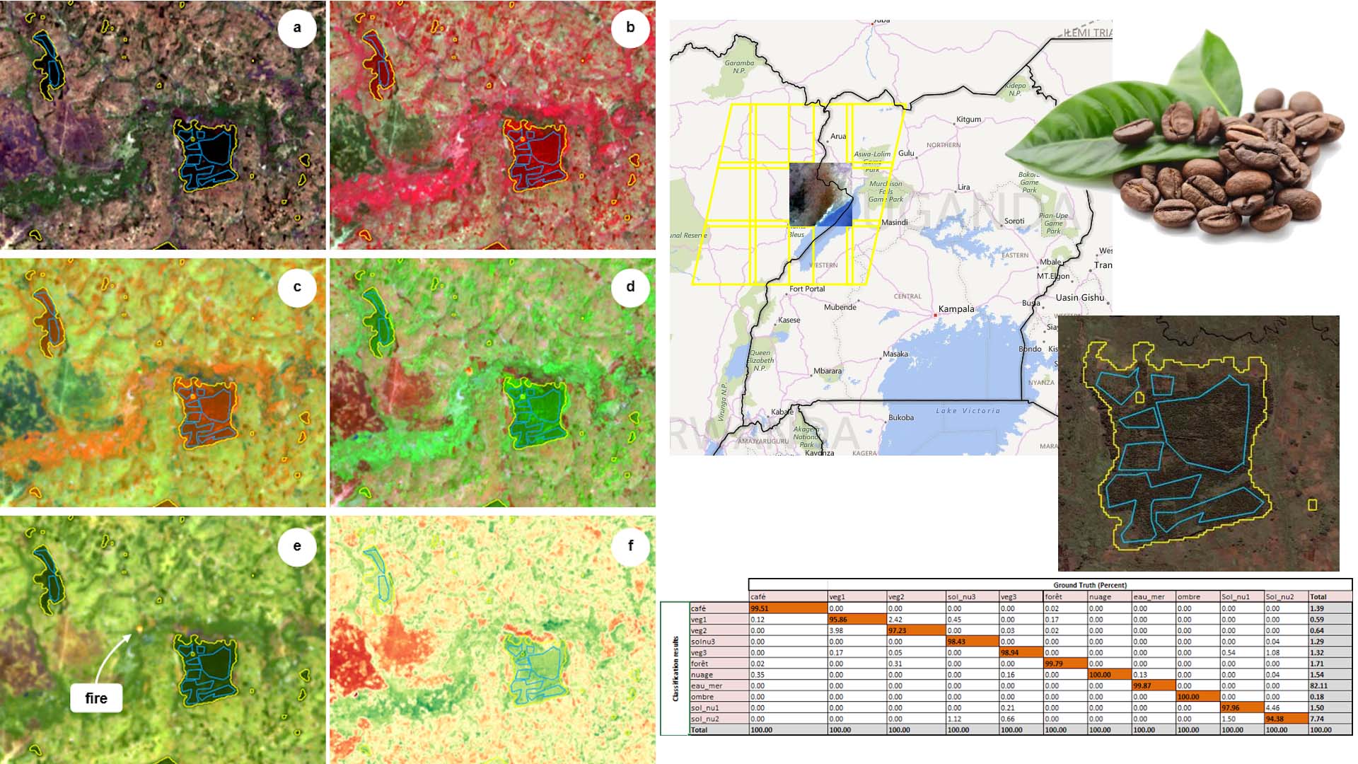
Cartographic production is most often used for studies. These studies require various types of images (optical, radar, DTM, vector layers, etc.) from different satellites, instruments, processing levels, models, etc., which VisioTerra correctly geocodes to ensure their spatial superposition and radiometric consistency. Thus, the most recent studies mix optical and radar data to improve the quality of classifications.