L’application "Sentinel Vision" The "Sentinel Vision" application
Sentinel Vision est une application client-serveur de l'Agence Spatiale Européenne (ESA) financée par la Commission Européenne (CE) et développée par VisioTerra sur le modèle de VtWeb.
Sentinel Vision permet d'accéder et de traiter à la volée tous les produits de tous les instruments de toutes les missions Sentinel, de les visualiser en 2D ou en 3D dans un globe virtuel et de partager les vues sous forme d'"hyperlooks" (URL riche conservant les paramètres de traitement d'un ou plusieurs produits).
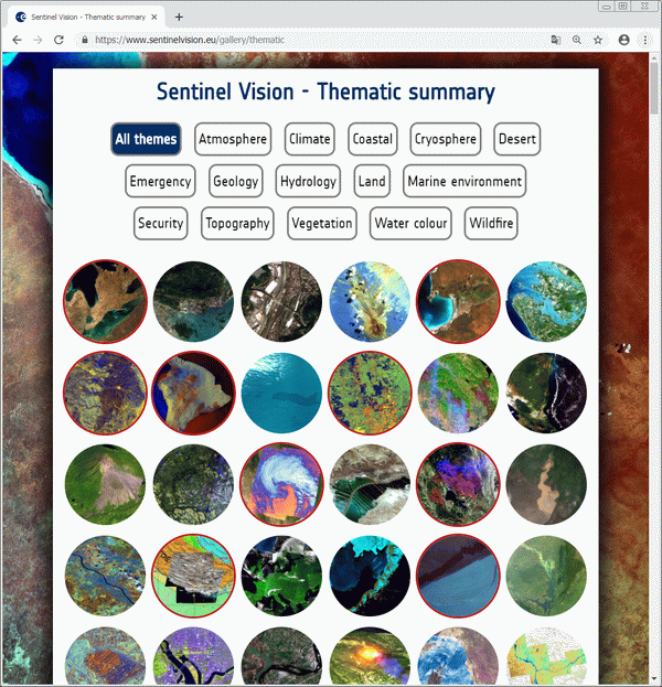
Depuis bientôt deux ans et demi, un "Service Sentinel Vision" contribue à la valorisation des données Sentinel en produisant 4 "stories" par semaine dont l'une contient plus d'hyperlooks et surtout des analyses, textes, citations d'experts d'un domaine. A ce jour, 472 stories sont disponibles dans différents formats interactifs:
Sentinel Vision is a client-server application of the European Space Agency (ESA) funded by the European Commission (EC) and developed by VisioTerra on the model of VtWeb.
Sentinel Vision allows to access and process on-the-fly all the products of all the Sentinel missions instruments, to visualize them in 2D or 3D in a virtual globe and to share the views in the form of "hyperlooks" ( Rich URL retaining the processing parameters of one or more products).
For nearly two years and a half, a "Sentinel Vision Service" contributes to the outreach of Sentinel data by producing 4 "stories" per week, one of which contains more hyperlooks and especially analyses, texts, and contributions from experts of a domain. So far, 472 stories are available in different interactive formats:
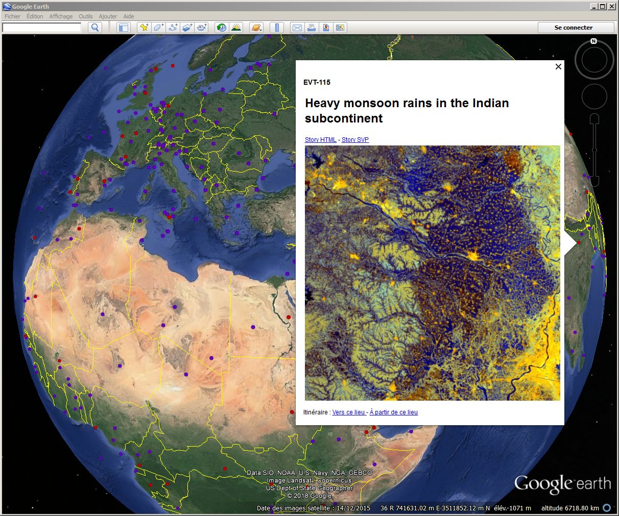
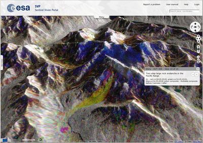
Fig.1: Stories dans Google Earth - "Sentinel of the day" (bleu) et "Event sheet" (rouge). KML Fig.1: Stories in Google Earth - "Sentinel of the day" (blue) and "Event sheet" (red).KML
Démontrer la diversité des missions Sentinel Demonstrating the diversity of Sentinel missions
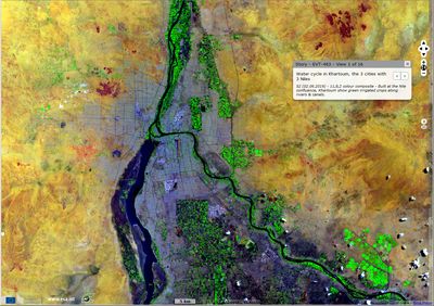
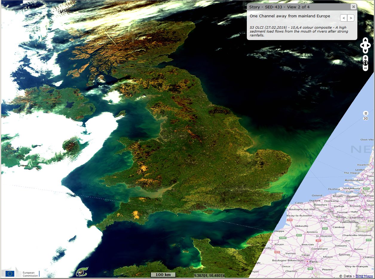
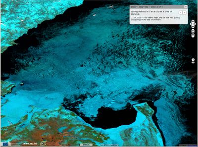
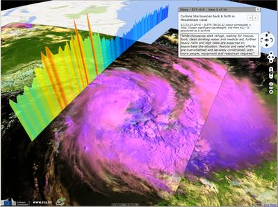
Fig.2: Vues de différentes missions (instruments) dans l'application "Sentinel Vision". Fig.2: Different missions views (instruments) in the "Sentinel Vision" application.
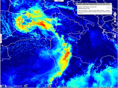
Image radar Sentinel-1 comparée à l'indice de neige (NDSI) de Sentinel-2 le 8 février 2018. Radar image Sentinel-1 compared to Normalised Difference Snow Index (NDSI) of Sentinel-2 on February 8, 2018. HTML - PDF - Animation 2D
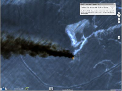
Incendie à bord du tanker Front Altair dans le Détroit d'Ormuz. Fire spread on the Front Altair tanker in Strait of Hormuz. HTML - PDF
Des traitements de données innovants Advanced data processing technics
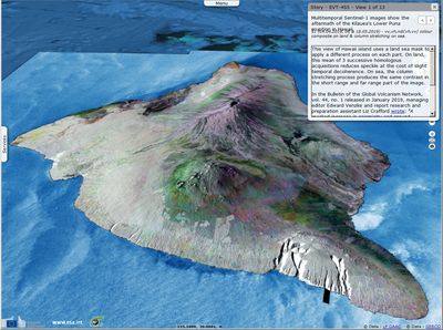
EVT-455 - Sentinel-1 - Hawaii A la volée: +Orthorectification zéro Doppler +Moyenne multi-dates +Egalisation de la section radar transversale +... On-the-fly: +Orthorectification from the zero Doppler physics +Multi-dates average +Radar cross-section equalisation +... HTML - PDF
Afrique: Sentinels en quelques clics Africa: Sentinels in few clicks
VisioTerra continue de militer pour simplifier l'accès aux données gratuites d'observation de la Terre, météorologiques, climatiques, biogéophysiques et socio-économiques. La solution VtWeb fait usage de traitements à la volée pour relayer ces données à travers une infrastructure libre d'accès offerte par VisioTerra.
VisioTerra advocates simplifying accessibility to free Earth observation, meteorological, climatic, biogeophysical and socio-economic data.The VtWeb solution makes use of on-the-fly processing to relay this data through a freely and accessible infrastructure offered by VisioTerra.
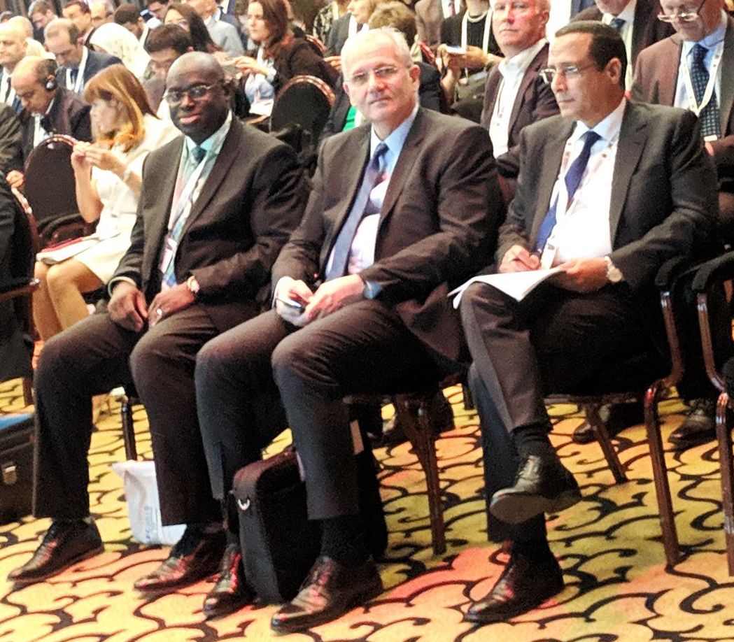
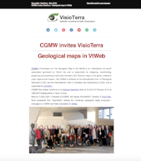
Ouafae KARIM et Serge RIAZANOFF ont représenté VisioTerra à la conférence GLEC2019 organisée par l'IAF, le CRTS et supporté par le CNES. Ils ont démontré VtWeb à plusieurs directeurs d'agence spatiales, de ministères et membres de la société civile. Parmi ces rencontres, on remarquera les entrevues avec (voir Fig.3 ci-dessous):
Dr. Tidiane OUATTARA intéressé par le potentiel de VtWeb pour -accéder facilement aux données, -les partager entre les organisations de projets tels que GMES&Africa, -supporter des services, -favoriser l'usage des données radar dans le contexte tropical.
M. Driss EL HADANI et Mme Amal LAYACHI pour qui les compétences de VisioTerra pourraient contribuer au succès des projets du CRTS dans les domaines des -infrastructures, -précision de la géométrie des images et du -support à la formation.
Ouafae KARIM and Serge RIAZANOFF represented VisioTerra at the GLEC2019 conference organized by IAF, CRTS and supported by CNES.They demonstrated VtWeb to several space agency Directors, Ministries and Civil society members. During these meetings, we will note the interviews with (see Fig.3 below):
Dr. Tidiane OUATTARA interested in the potential of VtWeb to easily access data, to share it between project organizations such as GMES & Africa, to support services, to favor the use of radar data in the tropical context.
Mr Driss EL HADANI and Ms Amal LAYACHI for whom the skills of VisioTerra could contribute to the success of CRTS projects in the fields of -infrastructures, -accuracy of image geometry and -support to training.
Fig.3: De gauche à droite: -Dr. Tidiane OUATTARA, responsable des affaires spatiales à la C.U.A., -Jean-Yves LE GALL, Président de l'Agence Spatiale Française (CNES) et -Driss EL HADANI, Directeur Général cu Centre Royal de Télédétection Spatiale du Maroc (CRTS). Fig.3: Left to Right: -Dr. Tidiane OUATTARA, Space Science Expert at A.U.C. , -Jean-Yves LE GALL, President of the French Space Agency (CNES), and Driss EL HADANI, Director General of the Royal Center for Spatial Remote Sensing of Morocco (CRTS).
Source: GMES & Africa.
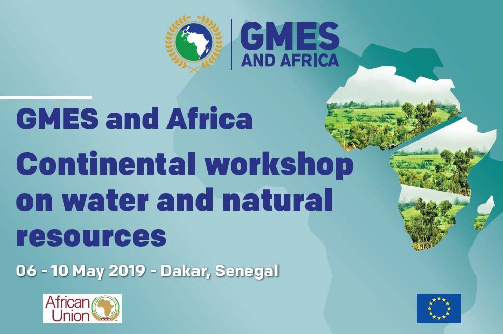
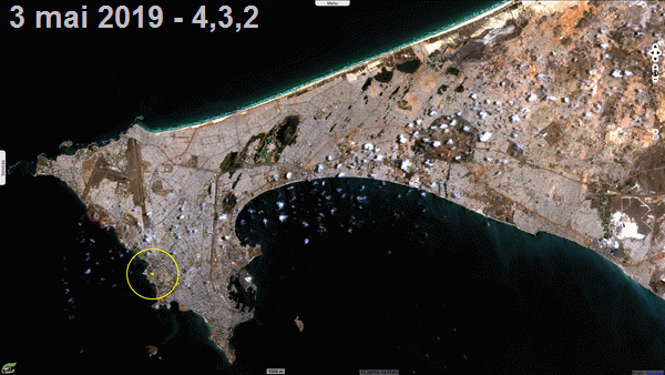
A l'invitation de Dr. Tidiane OUATTARA, Serge RIAZANOFF a participé à l'atelier continental GMES & Africa consacré à l'eau et aux ressources naturelles. A cette occasion, il a pu démontrer VtWeb manipulant des gigaoctets de données tout en utilisant une modeste connexion GSM sur son smartphone. Trois vues ont été partagées avec l'assistance sous forme d'hyperlooks. La Fig.4 ci-dessous montre les différents traitements à la volée (styles) qui ont pu être paramétrés interactivement et appliqués à une image Sentinel-2 récente sélectionnée avec l'assistance. Thanks to Dr. Tidiane OUATTARA's invitation, Serge RIAZANOFF participated in the GMES & Africa continental workshop on water and natural resources.On this occasion, he was able to demonstrate VtWeb handling gigabytes of data while using a modest GSM connection on his smartphone.Three views were shared with the assistance in the form of hyperlooks.Fig.4 below shows the different on-the-fly processing (styles) that have been interactively set and applied to a recent Sentinel-2 image selected with the participants. .
Fig.4: Sentinel-2 acquise le 3 mai 1989 et traitée à la volée en couleurs naturelles (4,3,2), en proche infrarouge (8,4,3), moyen-infrarouge (11,8,3), indice de végétation (NDVI) et indice d'humidité de surface (NDWI-SM). Fig.4: Sentinel-2 acquired on May 3, 2019 and processed on-the-fly in natural colours (4,3,2), near-infrared (8,4,3), shortwave-infrared (11,8,3), normalised difference vegetation index (NDVI), and normalised difference water index / surface moisture (NDWI-SM). Animation 2D
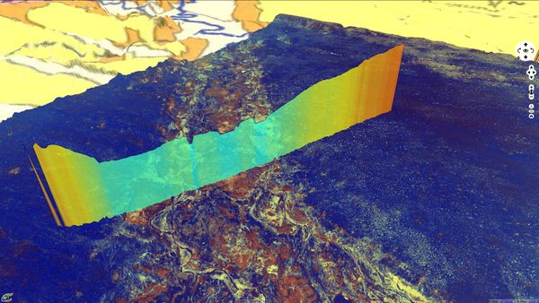
Fig.5: Profil altimétrique Sentinel-3 SRAL acquis le 5 mai 2019 au-dessus d'une scène radar Sentinel-1 acquise le 4 mai 2019. L'élévation du relief est exagérée d'un facteur x75. Fig.5: Altimetry profile Sentinel-3 SRAL acquired on May 5, 2019 over a radar scene acquired on May 4, 2019. Relief is magnified by a x75 factor. Vue 2D - Vue 3D
Les opinions exprimées dans ce document reflètent uniquement les résultats des travaux et l'opinion de VisioTerra.
The views expressed herein reflect solely the results of the works and the opinion of VisioTerra.