
References


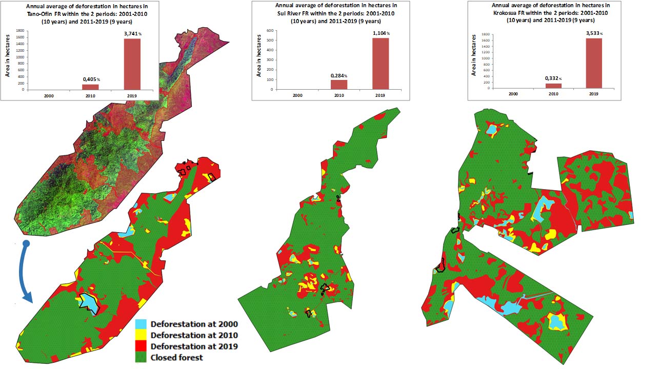
Analysis of forest degradation since 2000 in favour of cocoa agroforestry in the forest reserves (excluding admitted farms) of Tano-Ofin, Sui-River and Krokosua using radar and optical images.
Study of deforestation in three Forest Reserves in Ghana Tropenbos International


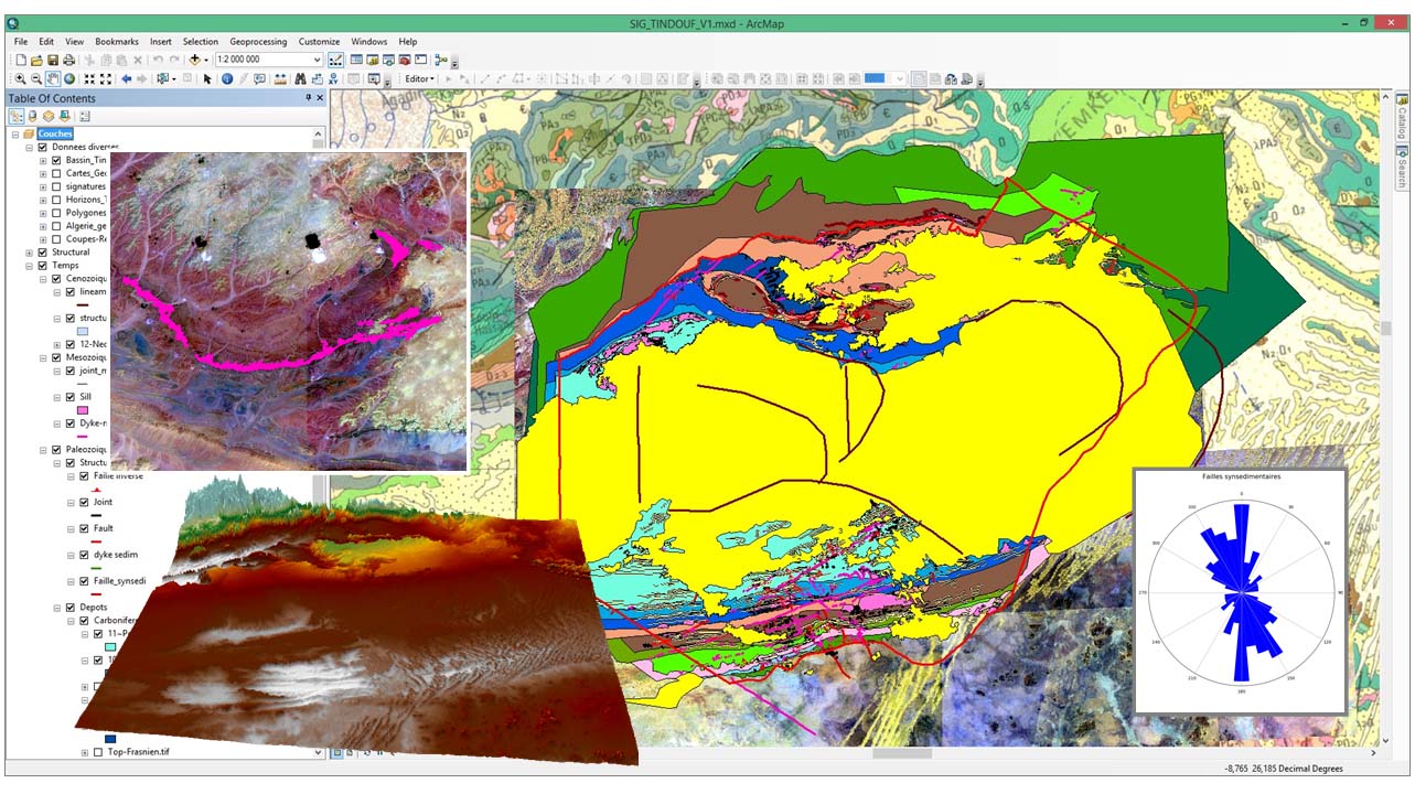
Supply and processing of images (radar and optical) on the Tindouf Basin (Algeria). Production of geological photo-interpretation maps.
Geological analysis in the Tindouf Basin Beicip Franlab / SONATRACH


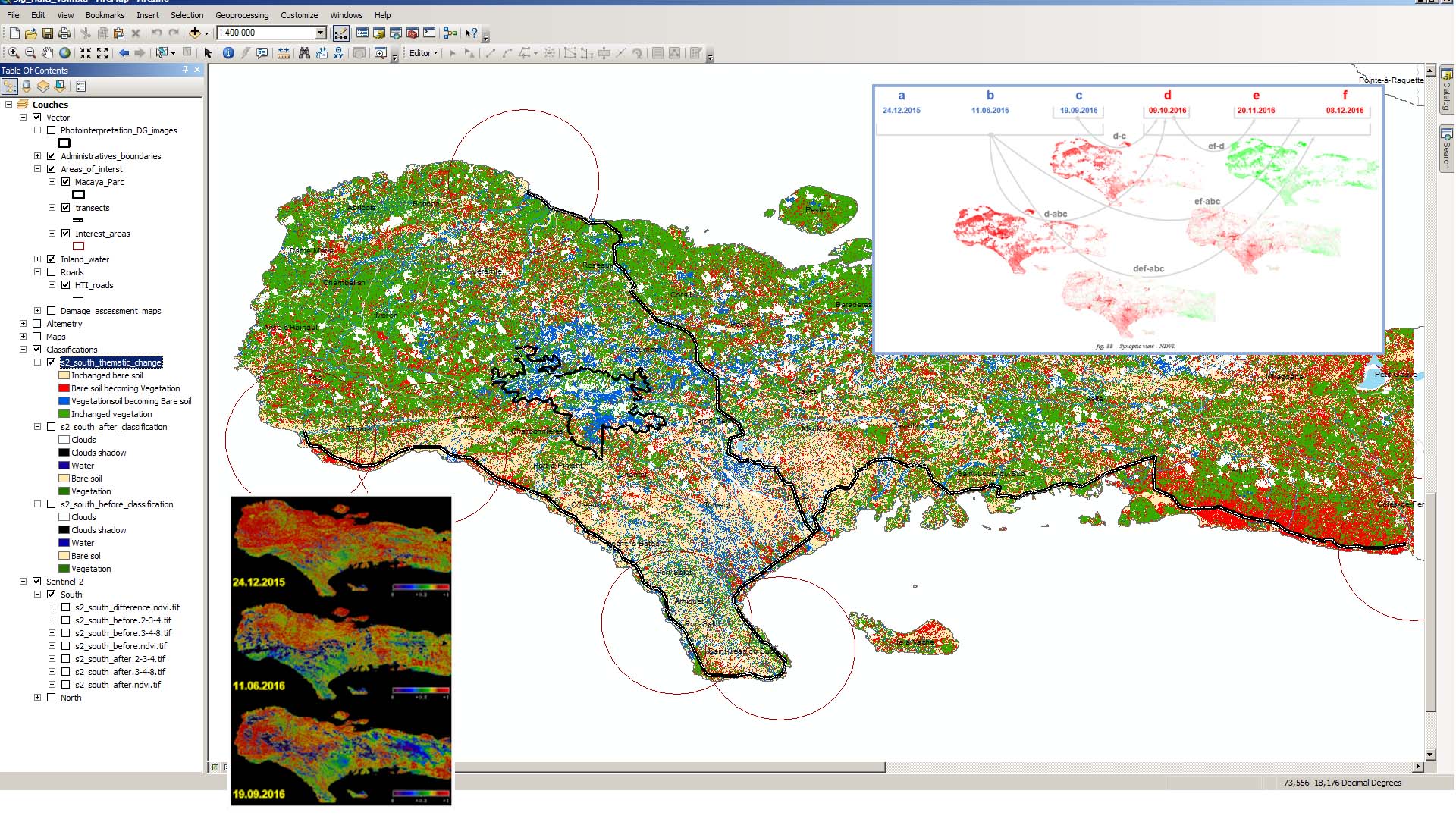
Sentinel-2 data were used to calculate differences in vegetation indices before and after Hurricane Matthew occurred on October 4, 2016.
Assessment of vegetation losses after Hurricane Matthew UNEP


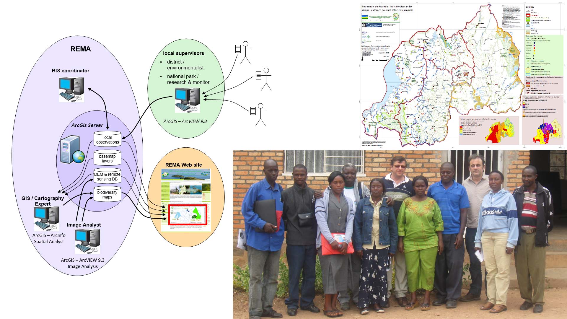
Rwanda Environment Management Authority (REMA) - Supervision of the RBIS project from the tender to the development of the software, the organization of the data and the different trainings.
REMA Biodiversity Information System (RBIS) REMA / World Bank


