Geocoding and processing of Landsat, Radar and DTM data for the production of LU/LC maps from field data and by supervised classification.
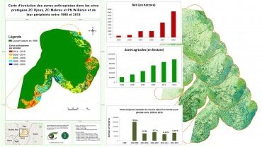
Dynamics of the land use of the protected areas ZC Djona, ZC Mekrou and PN W-Benin and their periphery from satellite data.
Evolution of land use in northern Benin APN Benin
APN Benin
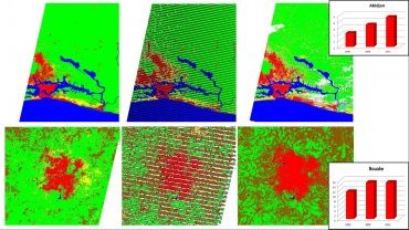
Production of land use classification maps and statistics for the study of urban growth in the cities of Abidjan and Bouaké in Ivory Coast.
Urban growth in Ivory Coast UNEP / OBSCOM
UNEP / OBSCOM
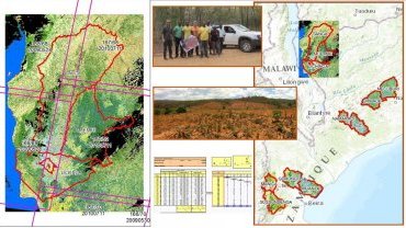
Production of land cover maps of 5 provinces of Mozambique from Landsat scenes and field data. Processing of Radar scenes. Orthorectification of SPOT scenes.
LU/LC from Mozambique Dobbin International / OBSCOM
Dobbin International / OBSCOM
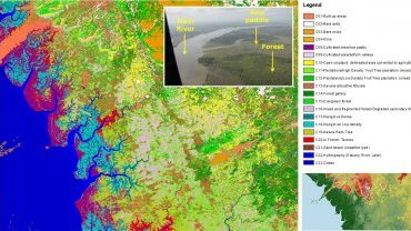
Production of a land use map of Guinea Rio Tinto / OBSCOM
Rio Tinto / OBSCOM
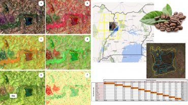
Detection of coffee plantations by classification in Mukono district, Uganda using Sentinel 2 multispectral data.
Coffee detection at Mukono AFCA
AFCA
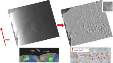
Geocoding and processing of radar segments and scenes to facilitate photo-interpretation of offshore oil slicks.
Mass production of geocoded radar data TOTAL
TOTAL