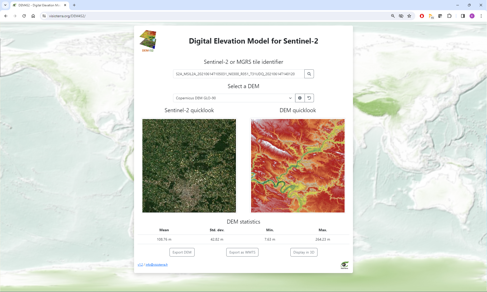
Access to DEM4S2 : https://visioterra.org/DEM4S2/ The Sentinel-2 satellites are part of a constellation whose first mission Sentinel-2A was launched on June 23, 2015. These satellites carry the MSI (Multi-Spectral-Instrument), an optical imager in the visible, near-infrared and mid-infrared range across 13 spectral bands. The swath width of 290 km combined with the high spatial resolution of 10 m produces a large volume of data along an observation segment. To enable data manipulation, Sentinel-2 data have been divided into 100 km by 100 km tiles according to a reference grid called MGRS (Military Grid Reference System). The DEM4S2 altimetry data, used to define relief, can be viewed and downloaded according to this grid.
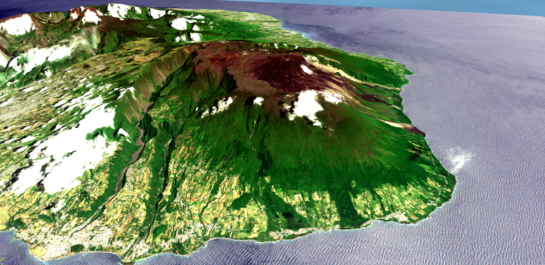
It is possible to view the digital elevation model only by entering the footprint (for example: 33TTG) or by providing the Sentinel-2 product identifier observed on this footprint (for example: S2A_MSIL2A_20240315T100031_N0510_R122_T33TTG_20240315T141852 ). Here is a list of different use cases for which DEM4S2 could be useful Calculating reflectance as a function of local incidence Understanding how L2A products have been corrected for sun exposure Easily display 3D views of scenes
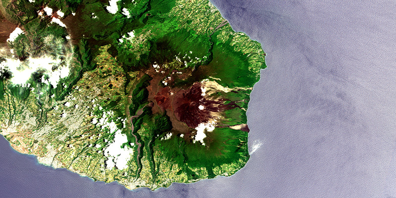
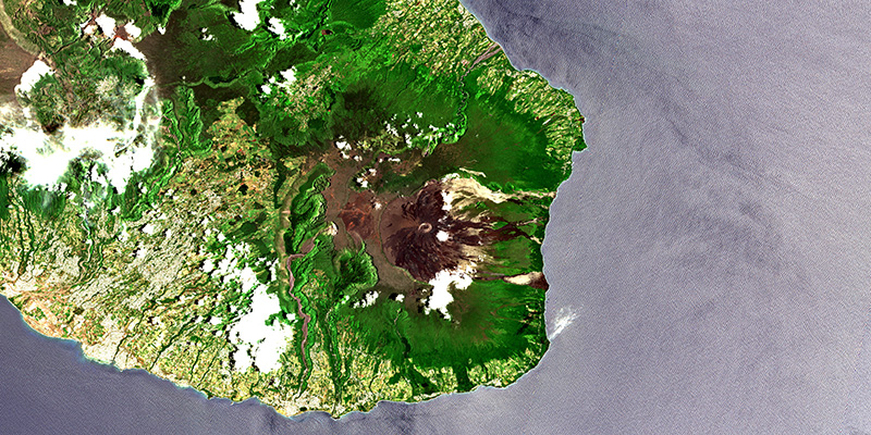
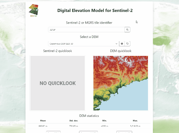
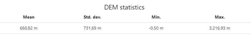
Digital Elevation Models (DEM) are used to orthorectify Sentinel-2 images in order to eliminate parallax errors due to shooting geometry and relief. As illustrated below, the user can choose which DEM to use. By default, DEM4S2 will present the DEM used for Sentinel-2 orthorectification. Since March 30, 2021, Sentinel-2 data have been orthorectified using the Copernicus DEM (COP-DEM GLO-90 then COP-DEM GLO-30). Depending on the version of the Sentinel-2 production chain, the DEM used for orthorectification may have changed (see: Processing Baseline).
.
Human Machine Interface
MGRS grid identifiers can be viewed from the "Sentinel-2 tiling grid kml" file.
Main features :
When the identifier of a Sentinel-2 product is provided, the application selects by default the DEM used for its orthorectification.
The drop-down menu below provides a detailed explanation of each available field.

Use cases